


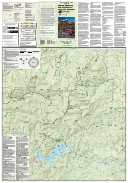
Mt. Hood Area Map & Guide
Price range: $13.99 through $25.00
Waterproof/Folded Map (for navigation out on the trails)
Laminated Poster Map (durable poster for display in your home, cabin, office or business)
Poster Map (printed on regular poster paper, suitable or custom mounting or framing)
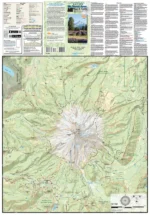
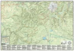
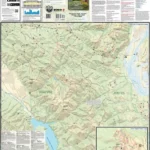
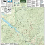
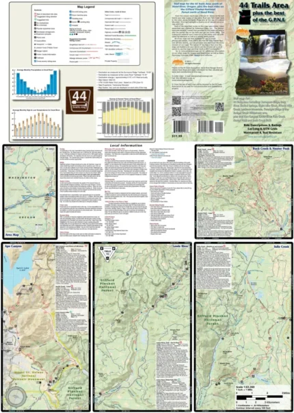
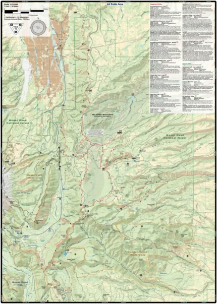
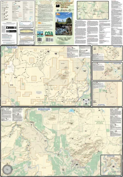
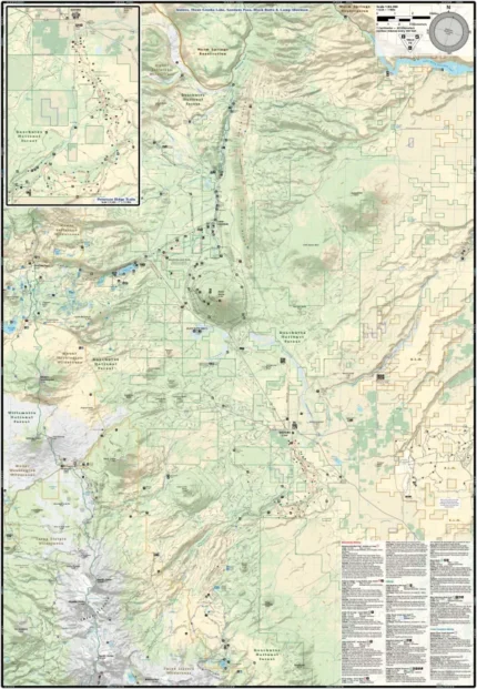
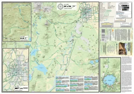
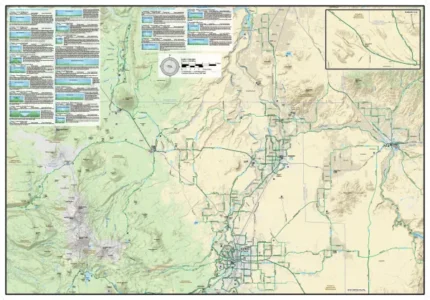
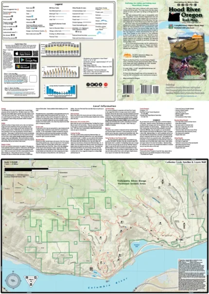
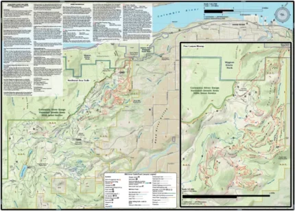
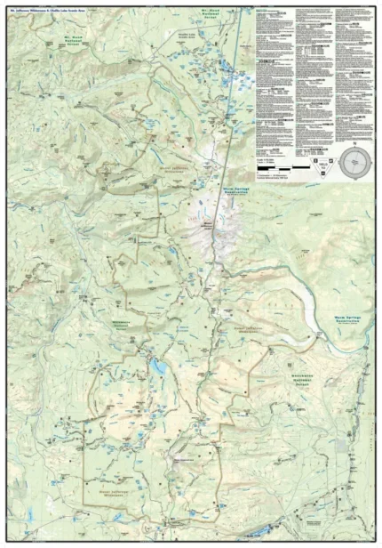
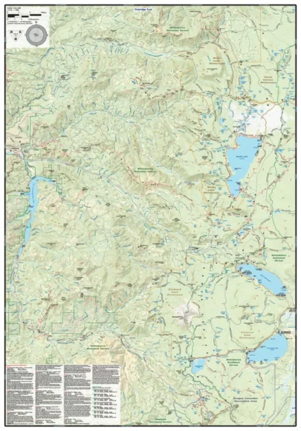
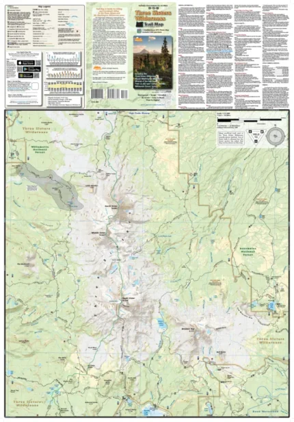
The Mt. Hood Area map (2020) is a waterproof, topographic (lat/long, UTM grids) trail map that includes hiking and mountain biking route descriptions covering trails in the Mt. Hood area including the Mt. Hood, Salmon-Huckleberry & Roaring River Wilderness areas, Timothy Lake, and Sandy Ridge Trails. Forests of huge old growth trees, lush undergrowth, clear mountain streams and the high alpine environment of Mt. Hood highlight this beautiful corner of Oregon. Routes range from easy roadbeds to remote backcountry trails with steep grades and technical challenges. Mountain bikers, hikers and equestrians will find hundreds of miles of trails on this map suitable for a wide range of skill and fitness levels. You will find route details for 11 mountain bike rides and 14 hikes. On this map are blowups of Mt. Hood and the Sandy Ridge Trails. Fishermen, hunters and OHV riders will also find this map very useful as it accurately shows all streams, lakes, roads, OHV routes and land ownership boundaries.
Our printed maps come with a free digital copy (arriving with your map) for use on smart phones and tablets. Use the digital map to gps navigate out on the trails (no cell service needed once map is downloaded); Use the printed Waterproof/Tear Resistant map for planning, as a backup in case your phone ends up in a creek, to cover your head in a rain storm or for good old fashioned navigating. Laminated Flat Maps and Full Size Poster options are also available (see below). Laminated maps and Posters make nice gifts as you can hang them on a wall.
Scale 1:63,360, 1:31,680
copyright 2020
| Map Type | Laminated Poster Map, Poster Map, Waterproof/Folded Map |
|---|
Only logged in customers who have purchased this product may leave a review.
Related products
Mount Jefferson, Bull of the Woods & Opal Creek Wilderness Trail Map
Price range: $13.99 through $25.00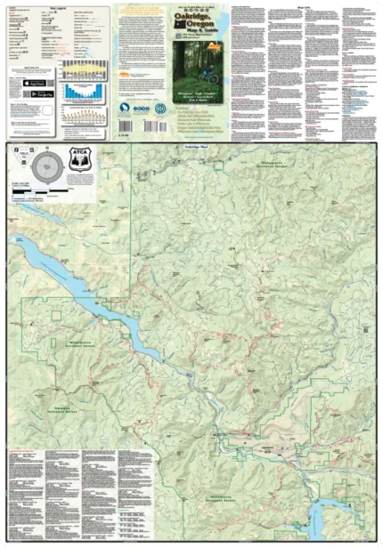

Reviews
There are no reviews yet.