


St. George, Zion NP & Hurricane, Utah Trail Map & Guide
Price range: $13.99 through $25.00
Waterproof/Folded Map (for navigation out on the trails)
Laminated Poster Map (durable poster for display in your home, cabin, office or business)
Poster Map (printed on regular poster paper, suitable or custom mounting or framing)
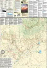
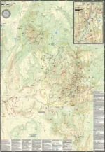
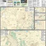
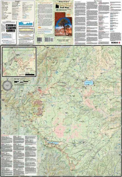
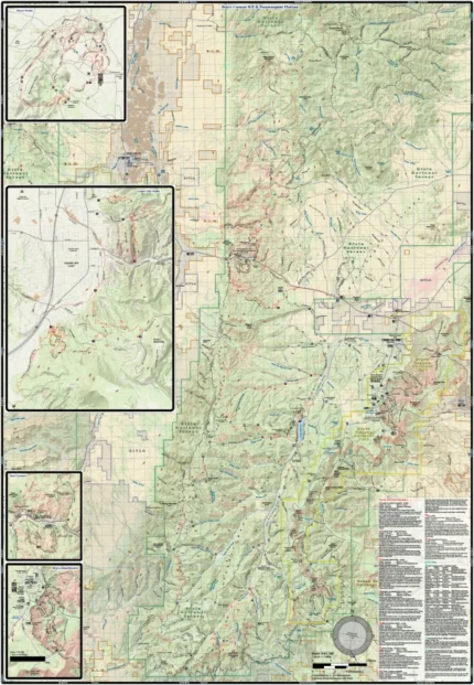
The St. George, Zion, & Hurricane, UT trail map (2021) is a waterproof, topographic (lat/long, UTM grids) trail map that includes hiking, mountain biking, dirt and road biking route descriptions covering St. George, Hurricane, and Zion National Park. Red rock formations, steep canyon walls solitary mesas and large forested mountains highlight this beautiful corner of Utah. Trails range from paved, all-access paths to remote backcountry routes with little or no signage. Hikers will find hundreds of miles of trails ranging from flat walks to technical scrambles with steep drops and immense solitude. You will find route details for 21 of the best mountain bike rides, 3 dirt bike rides, 8 road bike rides and 12 hikes. On this map is a blowup of Zion Canyon. Amongst the trails, you’ll find routes for equestrian and OHV uses.
Our printed maps come with a free digital copy (arriving with your map) for use on smart phones and tablets. Use the digital map to gps navigate out on the trails (no cell service needed once map is downloaded); Use the printed Waterproof/Tear Resistant map for planning, as a backup in case your phone ends up in a creek, to cover your head in a rain storm or for good old fashioned navigating. Laminated Flat Maps and Full Size Poster options are also available (see below). Laminated maps and Posters make nice gifts as you can hang them on a wall.
Scale: 1:63,360, 1:31,680
copyright 2021
| Map Type | Laminated Poster Map, Poster Map, Waterproof/Folded Map |
|---|
Only logged in customers who have purchased this product may leave a review.
Related products
Reviews
There are no reviews yet.